Geography of Ancient Rome
November 9, 2010 § Leave a comment
On Friday 12th November there will be a quiz on material that we will cover in class this week. You need to be able to do the following:
1. Label a map of Ancient Rome (see map below – click on map to enlarge)
2. Explain the geographical advantages that led to Rome’s success. The paragraph from your textbook is reproduced below for your reference.
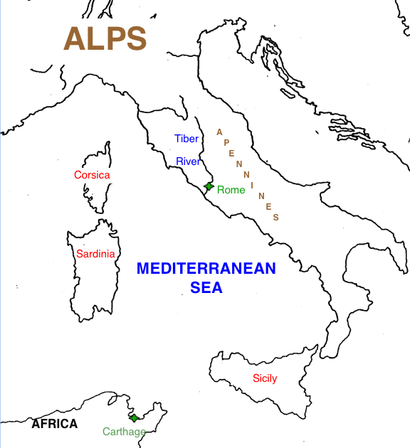
Geographical Advantages:
The first people who settled on Rome’s seven hills were not thinking about building a great empire. They chose that site because it seemed to be a good place to live. The hills made the area easy to defend. The soil was fertile and the area had a good source of water. From the mountains of central Italy, the Tiber River flowed through Rome before emptying into the Tyrrhenian Sea. But as time passed, the people of Rome discovered that the location of their city gave them other advantages. Rome was at the center of the long, narrow peninsula we now call Italy. Italy was at the center of the Mediterranean Sea. And the Mediterranean Sea was at the center of the known Western world.
[World Studies: The Ancient World. Prentice Hall p. 211].

Leave a comment